How we're using AI: Create spatial boundaries from simple prompts
.png)
Spatial analysis has the power to transform logistics operations, but it comes with a catch – the complexity.
Before you can start the analysis, there’s significant preparatory work involved. Gathering and processing large amounts of data, as well as defining the geographic areas for analysis, requires specific technical skills.
Our goal has always been to make powerful spatial analysis available to parcel and postal operators regardless of their technical background.
That’s why, after making it easy to get real POI data with prompts, we’re now tackling defining spatial boundaries without wrestling with GIS formats or spending time drawing polygons. And we're making it as simple as a conversation.
Generate areas with a simple prompt
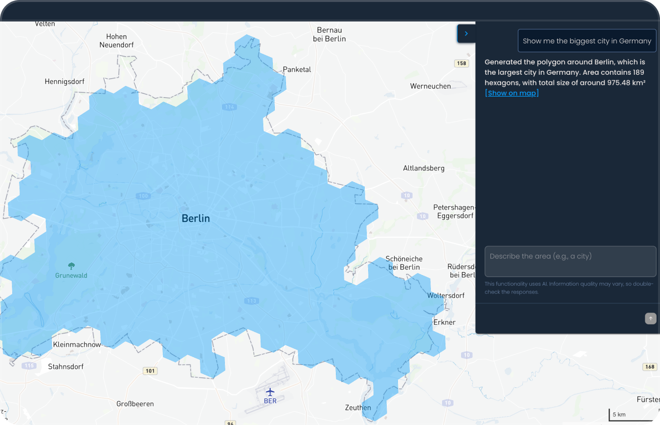
Simply describe the area you want to create, e.g., 'Show me Berlin,' or ‘Show me the largest city in Germany,’ and the model will map out the geographic area for you. Keep chatting to add or remove parts of the geographic area.
Use these areas as your foundation for analyzing workload distribution, planning delivery routes, optimizing out-of-home delivery networks, and more.
How it works
We’ve combined Anthropic’s Claude 3.5 Sonnet model with enriched private and public data to draw boundaries that match real-world geographic areas.
Currently in beta
The feature is currently in beta and being tested by our customers.
We're continually working to improve the model and provide more accurate results. We're also busy planning the next AI-powered features that will simplify analysis and help teams make more confident decisions.
Until then, if you’d like to see how easy network planning can be with the Mily Tech platform, get in touch.


.png)
.png)